Tuesday, November 30, 2010

Yorke Peninsula (East Coast):


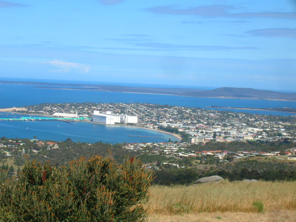
Edithburgh was our next stop which had a historical jetty and a massive wind farm. We then followed the coastline up to Stansbury. We passed some huge silos where they send the grain out to a waiting ship by a large overhead chute.

Stansbury is a delightful little town which I loved and the caravan park was right on the foreshore. It is a very popular place with the Adelaide people as it is only a couple of hours away and a very good fishing, crabbing area and swimming area and the park is spotless. You can actually rake the crabs out of the sand when the tide is low. Many people store their van here very cheaply and the park tows it out to your site when you come so that’s what a lot of the Adelaide people do. No wonder people who like seafood like this place and I think nearly everyone goes fishing.
It was a beautiful day so finally the bikes came out and we rode along the foreshore 
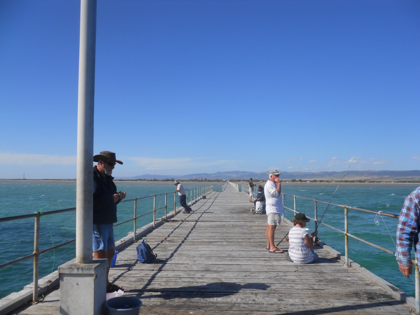
to the jetty which was at the other end. We rode out onto the jetty to check out the catches. Most people were successful and we chatted to a young couple who caught two huge crabs.
There was a coffee shop which had the best vanilla slice I have ever tasted so note that!! We even went back for seconds the next day (just when I had decided to start eat more healthily). We also had fresh fish and chips for tea that night. Oh dear!!

The next day was windy, cold and overcast. We headed to Port Vincent another beachside village close by which seemed very nice and people were fishing from the footpath at the bottom of the main street. There was a small marina so we checked this out. Apparently it’s popular to sail from Adelaide to here on a weekend.

We went on to Port Julia as there was a free camp there (well $6 per night). It was an oval which was surrounded by some dense bushes that provided some shelter from the blustery wind. We checked out the jetty and a “red shed” which was used to store the bags of wheat and wool in the early days.
We didn’t explore much more as it was too windy so spent time reading and watching a movie.


We only had eleven klms to go the next day so had a late start and stayed at Black Point where we had an ocean front view of the coast but could hardly open the caravan door the wind was so strong. There are lots of beach shacks right up to the high tide level but also there are lots and lots of new holiday homes. It almost feels like Adelaide has just discovered this area. The sun did come out for a while but the wind didn’t give up all day. We went for a drive to the end of the point where there is a lot of land for sale. A short walk on the shore revealed a four-wheel drive bogged on the beach – you could see where the tide had come as there was some seaweed hanging over the side mirrors!! I think the car might be ruined.


After a rainy windy night we set of for Ardrossan where there is a dolomite mine.
We drove down to the jetty to see some steep red sandstone cliffs which I believe turn really red when the sun shines on them. It was freezing here so we didn’t feel like doing much sightseeing. Where is the summer!!! After a coffee we keep going hoping to outrun the weather.

We had to pick up some mail at Port Wakefield. This town was oozing with wonderful historic buildings. Every building is built from stone and is very old. There was a quaint craft shop which used to be the CWA meeting room. What a great variety of craft they had and the ladies were very friendly.
We checked out the jetty and then had lunch near a large wetland area. There are a lot of mangroves which are important habitat for many creatures.

We stayed at a free camp at Port Parham which is seems to be full of holiday shacks and is quite close to Adelaide. It was extremely shallow and the tide went out a long way. We went for a walk in the fierce cold wind and were fascinated to see many versions of homemade tractors on stilts in almost every yard. This was to tow their boats out to deeper water and I guess leave them out there. We would love to see them in action.

We decided to get to Adelaide a day earlier to get away from the wind.
We really enjoyed the Yorke Peninsula with its friendly laid back atmosphere and their lack of commercialism. Let’s hope it stays like that.

Sunday, November 28, 2010

Yorke Peninsula: (West Coast)


Yorke Peninsula is – fishing, oysters, blue crabs, squid, wheat and barley crops, jetties, ports, roses, beautiful old buildings – lots, lay back atmosphere. These are the things that come to mind in this beautiful part of the world.

From Port Augusta we set off down the Yorke Peninsula which is in the shape of a boot and is only a few hours from Adelaide.

All along the coastline are dotted small towns quite close together. Most of them here have a jetty as they were so reliant on shipping in years gone by to transport wheat, wool, gypsum and salt. Hence a lot of these villages have been named Port and there was always busy activity in the Ports. As the ships became bigger and steamers took over, the jetties were extended into deeper water. Eventually, when shipping was no longer used as a mode of transport because of trains and later road transport, the jetties fell into disrepair. Now most of the jetties have been restored and are very popular for fishing and crabbing. There little towns are very historic and have lots of old stone buildings but unfortunately because of the proximity to Adelaide there are many ”flash” holiday homes appearing. Luckily there still remains a relaxing atmosphere in the towns and there are very few shops or commercialism.

We stopped at Port Germein which has the largest wooden jetty in the southern hemisphere. The friendly caravan park was on the foreshore and just across the road from the jetty which we discovered was really long – well over a kilometre!!

This area is known for its crabbing and you could hire a crab pot for $2 and we were even given some bait – so off we went on the long hike to the end of the jetty to try our luck. It was fun to fling the crab pot out as far as you could. While you are waiting you can go and chat to other hopefuls. No feeling bites or nibbles in this game – just patience to leave the pot in long enough to allow the crabs to get trapped. When you do decide to pull it up you have to do so quickly so you prey doesn’t swim out. Crabs have to be a certain size before you can legally keep them so you have a measurer which the caravan park lent us. You hold it by the nippers while you measure. I commandeered a fellow fisherman to do this. I think he was fascinated as I was taking photos of each step and of course quizzing him on what to. It was quite exciting to haul the pot up with a squirming crab only to realize it was quite small so you throw it back. Most of the ones we caught were undersize but we did catch three and one of mine was quite big. I like it as you don’t have to unhook a poor fish. We then took our catch back to cook up and for me to try. We had good instructions on how to do this. Brian did the putting them into boiling water – I don’t think I would have liked to see that!!! Well sad news – I didn’t really like the taste of them and the fishy smell – sorry all you seafood lovers!!! But it was lots of fun.

We found a quirky “junk” shop crammed full of bric–a-brac, junk and collector’s items. It even came with resident skeletons as well as cobwebs. Brian bought some bolts from the old Ghan railway.

We travelled quite a distance the next day through lots of wheat fields. We came to a town called Moonta. Copper was found in the area and there was an influx of skilled miners from Cornwall and with them came Cornish traditions including the Cornish pasty. A big Cornish festival is held every second year. Brian tried a Cornish pasty. There were some beautiful old buildings here.

Port Victoria is a lovely little beachside village and the caravan park is overlooking the bay and the Jetty. We watched the sunset silhouetting the jetty in vivid colours. Lots of people were fishing on the jetty. There was a fish and chip shop, cum post office plus gift shop near the jetty and very few other conveniences. We spent time relaxing and observing the view and checking out how the fishing was progressing.

On the way to our next stop, Port Turton, we passed through a town called Minlaton which is known as the Barley Capital of the World. Housed in Minlaton is a Bristol monoplane which is its original condition. It was owned by a local Harry Butler a local daredevil. The plane was called the Red Devil.


Our site at Port Turton Caravan Park was on the upper level overlooking the ocean. This is a new part of the caravan park that was being upgraded. We were glad to be up there as it we were fanned by cooler breeze. There was a large group belonging to Australian Retired Persons Association (fishing chapter) in the lower part so we were extra pleased to be in heights. The jetty was very busy as they receive prizes for most fish caught etc. Apparently this organization has all sorts of interest groups who meet regularly and go on trips together.

We went on a drive along the cliff tops to a lighthouse which is on the tip of the toe of the boot which is the Yorke Peninsula. It was amazing how many houses were stretched out along coastline considering the actual town was so tiny.


The next day was very overcast and we were going for a drive down to Innes National Park which is right down the bottom. It is very beautiful with pristine water. A jetty here was used to take gypsum away. It had been beautifully restored and you could see where the gypsum was pushed down from the top of the cliff.


There are lots of beautiful beaches with white sand and a 360 degree lookout but by this time it was raining heavily so we couldn’t really see very well. We were going to go on a scenic drive along the coast but the visibility was poor and the road was dirt so we missed that as well.

We left the next day and had to get some supplies at Yorketown which is supposed to be the biggest town on the peninsula. It was only very small too. I think this is the charm of the area.

Tuesday, November 23, 2010

Eyre Peninsula (East Coast)

We continued on to Port Lincoln which is on a huge bay that is three times the size of Sydney harbour.Our caravan park overlooked the bay so we had a good view The town is famous for the tuna and many people have become very wealthy from tuna fishing as is evident from the huge houses that overlook the bay. There is also a very sophisticated prawn industry and crayfish are caught as well. It has also a huge wheat terminal where the wheat is brought from all over the Eyre and is exported from here.

We visited a fascinating museum dedicated to boats as there was a Finnish man who decided to settle here in the early days and he built many many boats. When he died the locals decided to perpetuate his memory by turning his workshop and slipway into a museum and keen boat enthusiasts spend time looking after the museum. Of course Brian was in his element. There were lots of models of old sailing ships as well as some real ones.

Port Lincoln is perched on the side of a hill and a lookout gives you a 360 view and gives you an idea of the size of the bay and views of the surrounding farmlands. It was very windy.

The next day we visited the fishing boat harbour which was fascinating. The prawn trawlers were unloading their catch. The operation is so sophisticated now that when
the prawns are caught they are cooked, boxed and snap frozen on the boat so we saw the “catch” all boxed coming out of the trawlers on a conveyer belt and being loaded onto a refrigerated truck to be sent all over Australia – these are your Christmas prawns folks!!

A similar process happens with the tuna where they are snap frozen whole, most of it going to the overseas market. It is the only place where they are frozen on the same day they are caught.

It was very windy and cold as we continued up the east coast of the Eyre through Tumby Bay which has some lovely old buildings and of course a jetty.

We were going to stay in a free camp called Lipson Cove which was beautiful and very isolated but it was really windy and there were no trees for shelter so we pressed on to Port Gibbon which was a tiny place with a few fishing shacks and a free camp. There are some big sandstone cliffs lining the beach. We walked to the end of the cliffs and saw that the galahs were nesting in some of the hollows. There are no large trees to provide a nesting spot for them. An old jetty provided shade for people on the beach.

From here we went to Whyalla which has a steelworks and ship building industry.
We were heading for a free camp just out of Whyalla so were just passing through. We had lunch on the foreshore. It was finally sunny and the water was very blue. There is a large warship outside the info centre which you could go on a tour through but the timing wasn’t right for us.

We went out to Lowly Point where there is a lighthouse, a small harbour and in the distance a facility for loading gas onto the ships. This is a where the free camp was. It was a beautiful day although still windy. At least it keeps the flies away. The area near the lighthouse is where giant cuttlefish come to breed and it is protected and no fishing is allowed nearby. A little further up the bay are some fish farms and the boat comes into the little harbour to load up with the fish food.

The next day we went to Fitzgerald Bay which is not far away and is a beautiful bay in the Spencer Gulf. You can see the Southern Flinders Ranges across the bay. The water was very blue so it was pretty. On our way out of here we got a puncture. To change the tyre is quite a chore as we have to take everything out of the back of the car.

Mobile again we headed for Port Augusta to get the tyre fixed and do some shopping.
We had now made it right around as we headed up the Centre from Port Augusta in May.

What amazing scenery we have seen and interesting places we have seen.

Sunday, November 21, 2010

The Eyre Peninsula :(West Coast)

Ceduna – the first town after crossing the Nullarbor. We had to pass through a fruit fly inspection point here as you are not allowed to take any fruit or vegetables into SA so you have to make sure you have eaten it all up. They inspect your van. The first thing everyone does is go and do some shopping.

Ceduna is a small neat town on the shores of Murat Bay. There is a grain terminal here where the wheat is taken away by the ships. You hear the train all night taking the grain out to the terminal. Salt and gypsum is also shipped from here.
This is a very large wheat growing area as well as a large oyster growing area and crabbing in season is a great pastime for locals.


Our caravan park was facing a lovely grassy foreshore which had a large jetty nearby.
We caught up with some people that we met in WA so we had drinks with them that night although it was quite chilly. We had great problems adjusting to the 2 1/2 hour time difference and found ourselves going to bed really late and sleeping in the morning.

The next day we saw some beautiful blue sky. We drove to to Denial Bay where there was a long jetty which people were fishing from. People also catch squid and you see the black “ink” all over the jetty. The water is very clear although there is quite a lot of seagrass which entangles hooks and also washes up on the beach and accumulates in black clumps.


On a walk out onto the Ceduna jetty we saw some kids catching crabs. There is a very strict rule about the size of fish and crabs allowed to be caught and as it was only the beginning of the crab season so most were too small.

We went for a drive to Pinky Point where you can get a view of the shipping terminal and see the islands that Dutch explorers named in 1627.

The next morning we left Ceduna for a small free camp at a little village called Haslam. This is mainly an oyster growing area and fresh oysters are very cheap.
There is a jetty where you can fish so we decided to give it try. We didn’t catch anything but I finally mastered the art of casting.
The water is shallow so a boat so when a boat comes in a tractor has to pull it out. When we were leaving in the morning we saw the tractor bringing all the fresh oysters to the shed. What a pity we don’t like oysters!!


Onto Streaky Bay which a quiet little town which of course has oysters as well.
There is a long jetty out into the bay. The jetties were very important in the early days as shipping was their only form of transport as well as goods and supplies. The wheat and wool were taken away by boat.
Matthew Flinders named Streaky Bay in 1802 and in 1839, Eyre the explorer set up a depot nearby for overland explorations to Point Bell and Albany.
It was an overcast day so the sea looked grey but at least it wasn’t raining.
We went on a drive around some of the rugged coastline in this area which was very impressive.


After we left Streaky Bay we called into an amazing rock formation of wind worn pink
granite which are called inselbergs that are believed to be 1500 million years old. The wind has carved out some very interesting shapes.


We continued on and decided to stay in a caravan park and were lucky to stumble on a picturesque little place called Venus Bay. It looked out over a very large bay which was as smooth as glass. It is a popular fishing place and most people have a boat. Lots of pelicans hang about the fish cleaning table for some titbits.

Once again there is a jetty and apparently prawn trawlers pull up here. The jetties used to have railway lines on them so the goods could be hauled out usually by horses.
The caravan park had a great camp kitchen with table and chairs looking out over the bay. It was like a classy restaurant. We cooked our meal and sat watched the view. It was still overcast which was a shame as the water would have been very blue.

I walked up to scenic lookout which looked over some magnificent rugged cliffs. These are limestone cliffs and are very unstable so you have to be careful not to get to close to the edge. Huge chunks of rock break off without warning. There was also a scenic walk around these cliffs and every corner turned up another amazing view. I keep walking and walking. The limestone was rather rough and then there were sandy tracks but the path became undefined and I wasn’t sure where to go and was a bit afraid of getting lost as I had walked quite a distance so I turned back. I was very tired by the time I got back and my feet were sore but it was worth it.
It rained in the night and was overcast and windy so we decided not to stay another night.

We continued down the coastline discovering some interesting places like Colton (which has one house) If the big sign says OPEN make sure you stop for some fresh wood fired bread and pay by and honesty box and coastal towns like Elliston where the whole town hall which was now the info centre was covered in murals depicting the early days. They had a brilliant exhibition of aboriginal art on display.

We found another campsite right by the beach which is very isolated. The sand very white but lots of sea grass gets washed up onto the beaches so they look a bit
untidy. Apparently the sea grass is important for the ecology and provides habitat for many creatures. The stumpy tail lizards are everywhere and you often see them crossing the road but I think this one was more interested in chasing her!!


Once more an overnighter, we stopped to view some more rugged cliffs where there is a memorial to a young local fisherman and onto Coffin Bay which is near the bottom of the Eyre Peninsula. We decided to treat ourselves to dinner at the pub and had some nice fish and chips. Coffin Bay is also famous for its oysters. It’s a sleepy little place but would be very busy in the summer as there are huge calm waterways here. It was still overcast so once again the water was grey.

There is a huge National park just past Coffin Bay and we went for an explore in the morning – more steep cliffs and lots of sandy coast line as well. There are lots of bays and islands so it was very pretty.

Monday, November 15, 2010

Crossing the Nullarbor:


If you think the Nullarbor is boring–it’s not
If you think it is all sandy and desert - it’s not!
If you think it has the longest stretch of straight road in Australia – it has.
The trip across the Nullarbor is 1434 kms from Norseman in WA to Ceduna in SA.

We left Kalgoorlie heading back to Norseman. On this trip you pass through the great Western woodlands. This is recognised as the largest and healthiest temperate woodland remaining on Earth. It stretches from the edge of the Wheatbelt to the Nullarbor Plain. There are many beautiful eucalyptus in this woodland.
We just refuelled at Norseman plus filled a jerry can as well for security and started on our trip across the Nullarbor. We planned to go about 370 klms per day stopping at free camps across the way.

At first there are trees as normal and then you see medium bushes but the whole area is covered with vegetation. I think there has been some rain as all the bushes had lots of new growth.
Gradually the trees become sparse and stunted, like twisted bonsai trees. The grass is yellow and dry dotted with some tufty stunted shrubs. As far as the eye can see it is flat.

When we came to Mundi Lookout you get quite a shock to see a large ridge running along and dropping down to a vast plain with just a few scattered trees and stunted shrubs. I didn’t realise that we were on a tableland and as we descended from the lookout we then were then travelling on this plain.

The next section is flat yellow dry grass, a few very low bushes and no trees. Although it is barren it feels majestic as you see how the plants adjust to this harsh climate.


When you get into SA the road across the Nullarbor runs very close to the Great Australian Bight. There are many look outs where you can view the magnificent Bunda Cliffs which are very sheer cliffs. The sea is very blue and clear. These cliffs are very unstable and you have to be careful not to get too near the edge. If you are here in the whale season you will see whales all along this coast line but we were too late – they have all gone past.


The vegetation here is amazing – just small tough low rounded bushes but if you put your hand on them they are either spiky or very strong. I guess they have to endure harsh winds and hot temperatures


Various parts of the Eyre Highway are marked runways where the Royal Flying Doctor Service can land in cases of emergency, we have passed over about 3 – 4 of these on our journey. The sides of the road have been cleared and are generally wider to allow room to land. We also passed the start of the dog fence which we drove along in the north of SA.
As we neared Ceduna you are really off the barren plains and are in the western wheat fields so we felt we were back in civilization again.

There is one and half hours time difference between WA and SA (plus an extra hour for Daylight saving) They advise you to turn your clock back three quarters of an hour before you get to SA and then another when you get to the SA border. I did this but when we got to Ceduna I realised that I had forgotten the extra hour for Daylight Saving. We took ages adjust.

It was a very interesting trip across and completely different tho expectations